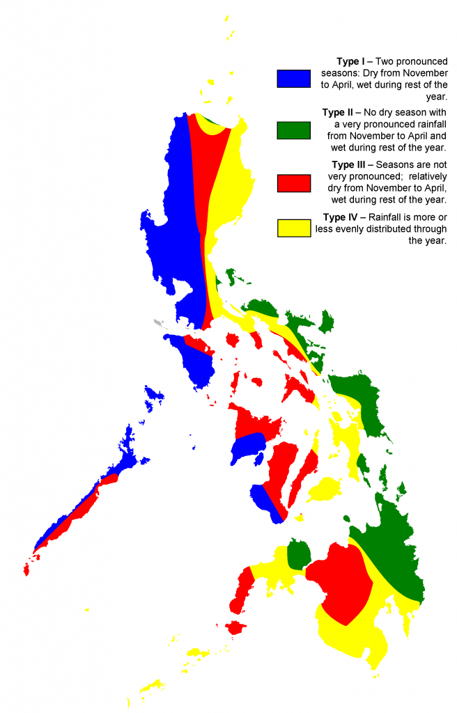
 Climate of The Philippines
Pagasa (Philippine Weather Administration Website)
Pagasa (Philippine Weather Administration on Facebook)
Public Alert Map
K’s weather (very informative Facebook page about local weather)
“This is NOT an “official” forecasting page.
It’s just my hobby. I am not a meteorologist nor a forecaster. I am a reporter of weather news, which I analyse first and then try to explain. “
Project NOAH (Nationwide Operational Assessment of Hazards)
“NOAH works to raise Filipinos’ awareness of natural hazards. We believe that an increased awareness of disaster risk is key in cultivating a culture of preparedness and reducing the catastrophic impacts of extreme hazard events. We do this by undertaking advanced disaster science research and comprehensive and multidisciplinary assessment of hazards. The results of these are developed into accessible tools that are relevant for local government units, community leaders, policy makers, planners, and families to prevent and mitigate disasters.”
Phivolcs
The Philippine Institute of Volcanology and Seismology (PHIVOLCS) is a service institute of the Department of Science and Technology (DOST) that is principally mandated to mitigate disasters that may arise from volcanic eruptions, earthquakes, tsunami and other related geotectonic phenomena.
Latest Earthquake Bulletins
HazardHunterPH is a tool that can be used to generate indicative hazard assessment reports on the user’s specified location. It is helpful as a reference of property owners, buyers, land developers, planners, and other stakeholders needing immediate hazard information and assessment. It aims to increase people’s awareness to natural hazards and advocates the implementation of plans to prepare for and mitigate the effects of hazards.
Save
Save