MT. LUMOT (MT. SUMAGAYA)- Balatucan Range, Misamis Oriental

Major jump-off: Sitio Harrohay, Brgy. Lunotan, Gingoog City
LLA: 8°40’51″N, 125°2’34″E, 2320 MASL (summit)
Days required / Hours to summit: 3 days / 8 hours
Specs: Major climb, Difficulty 5/9, Trail class 3
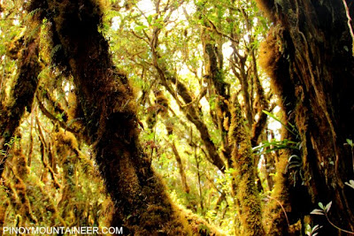
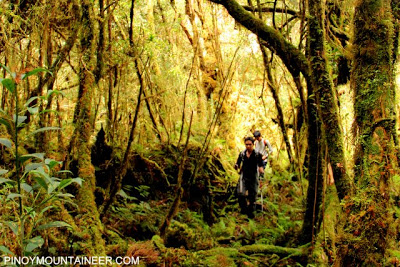
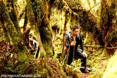
Remembered as the crash site of Cebu Pacific Flight 387 in 1998, Mt. Lumot, termed as “Mountain of Souls” by the local Higoanon people, is an emerging hiking destination in Gingoog City, Misamis Oriental. It is a high point of, not a distinct mountain from, Mt. Sumagaya. The tragic plane crash is still fresh in the mountain as remnants such as clothes and accessories can still be seen in the trail; the impact site is also preserved. Also, a shrine has been erected in memory of Flight 387; this shrine is located at the major jump-off. Every year, a tribute climb is organized, the last one being held on Feb 1-3, 2008. (Source)
The Sumagaya-Lumot Traverse Dayhike (Source)
More about Mountain Climbing/Hiking
| Website: | no page found |
| Facebook: | no page found |
| Email: | no email found |
| Landline: | no number found |
| Mobile: | no number found |
| City/Municipal: | Gingoog City |
| Barangay: | Lunotan |
| Address: | no street address found |
| Google Map: | Mt. Lumot |